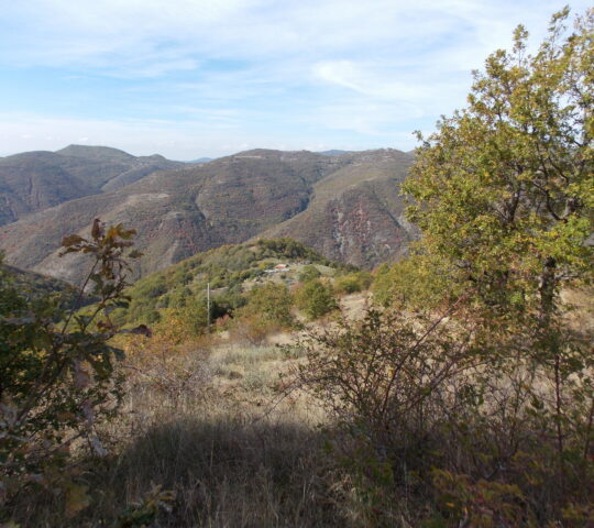
The route is located in the area around Zletovo, more precisely in the area of the local road leading from Zletovo to the Knezhevo dam. The route starts from the place called Holy Water and ends at the mountain peak called Panair (in the Osogovo Mountains) at the height of 1669 meters above sea level.
The length of the route is 8 kilometers in one direction.
The route is 8 km one way, easy to climb for all ages, does not require special physical training, is especially suitable for hiking in summer due to the thick shadows. This is a classic forest hiking trail. At the same time, the attractive fish restaurant Zletovitsa, the women’s monastery of St. Spyridon the Miracle Worker. One of the most attractive parts is the Zelenigrad waterfall, with a height of about 15 meters, where mountaineers can cool off. Several springs are located along the trail. The trail abounds with diverse animal and plant life, especially medicinal herbs. The route ends at the highest peak in the municipality of Probišip, Mount Panair, at a height of 1669 meters, with an extremely attractive view of the Osogovo region. From there you can see the mountain peaks of Sultan Tepe, Rouen, Tourtel.
Fair Mountain Peak
According to the geographical location, the municipality of Probistip borders Ovche pole in the west, Kochanska valley in the southeast, resting on the Kratovo volcanic rocks and the Osogovo mountain massif in the north and northeast. The northeastern and northern part of the Zletovo district is a hilly and mountainous area filled with medieval mountains dominated by crystalline schists and volcanic eruptive rocks. The highest peak in the district of Zletovo is “Tsarev Vrah” (Sultan Tepe), with an altitude of 2,085 meters, and on the territory of the municipality of Probership is the mountain peak of Panair with a height of 1,669 meters. To the east-northeast and to the west-southwest, between the Zletovska and Kratovska rivers, dominates the volcanic mountain range, which includes the mountains Bukovec (1,424 m), Plavitsa (1,298 m) and Cheren Vrakh (peak) (1,115 m.).

Maps
More Information
-
Accessibility:
By car, bicycle, horse, foot, etc.
The route can be traversed by walking. - Seasonality The trail is accessible all year round.


